
Above is a google Earth image of the Wood Lot. It spans from Tall Pines Road all the way to the solar panels off Camelot Dr.
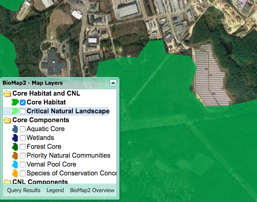
This photo was taken using OLIVER MassGIS. Which is an online data viewer with layered maps of ecological data. Please check out the facts for yourself: http://maps.massgis.state.ma.us/map_ol/oliver.php
CORE HABITAT: Species of conservation concern
Many species in MA that are under conservation concern face threats that are from habitat loss and climate change factors. This map targets conservation needs of individual species, particularly uncommon and potentially threatened species. There are 435 native plant and animal species listed under the Massachusetts Endangered Species Act (MESA).
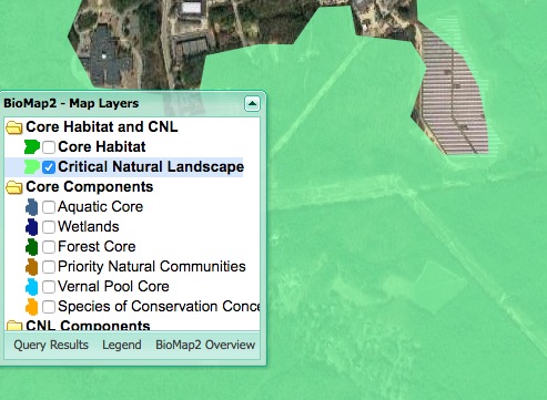
Critical Natural Landscapes:
The dynamic nature of intact landscapes provides an array of habitat types and patches that support an immense diversity of species. Conservation of landscapes is crucial to ensuring the long-term persistence of rare and native species and their habitats.
Landscapes and core habitat are complementary each represents biodiversity in MA. However, they each focus on different criteria.

Species of Conservation Concern:
Species of conservation concern include species that meet the criteria for listing under the Massachusetts Endangered Species Act, in addition to some that are considered a special concern. A species must meet strict criteria including rarity, population trends, and threats to survival.

in·hab·it·ant
/inˈhabədnt/
noun
plural noun: inhabitants
a person or animal that lives in or occupies a place.
That’s what in says on the map. It doesn’t mean clear cutting or development. Inhabitants of Plymouth County and animals ,not a few money hungry developers. Look what they did behind Home Depot, complete destruction.
LikeLike
You’re right. The fact that the town officials allowed the area behind Home Depot to be destroyed without proper planning is deplorable. Especially because the revised development plan did not even require the amount of deforestation that took place. The parcel of the Wood Lot does not have an end use land plan yet. Please join us at the Wood Lot meeting on February 28th and voice your concerns. Thank you for your support!
LikeLike